Angkor Wat
- Dated
- Place
- Angkor, near Siem Reap, Cambodia · Khmer Empire, reign of Suryavarman II
- Coordinates
- 13° 25′ N · 103° 52′ E (approximate)
- Remains
- Intact
This fragment shows an object held as sacred.
It is shown here as the institution that holds it presents it. Some communities connected to it ask that it be viewed with care. You may choose to see the image, or read the record without it.
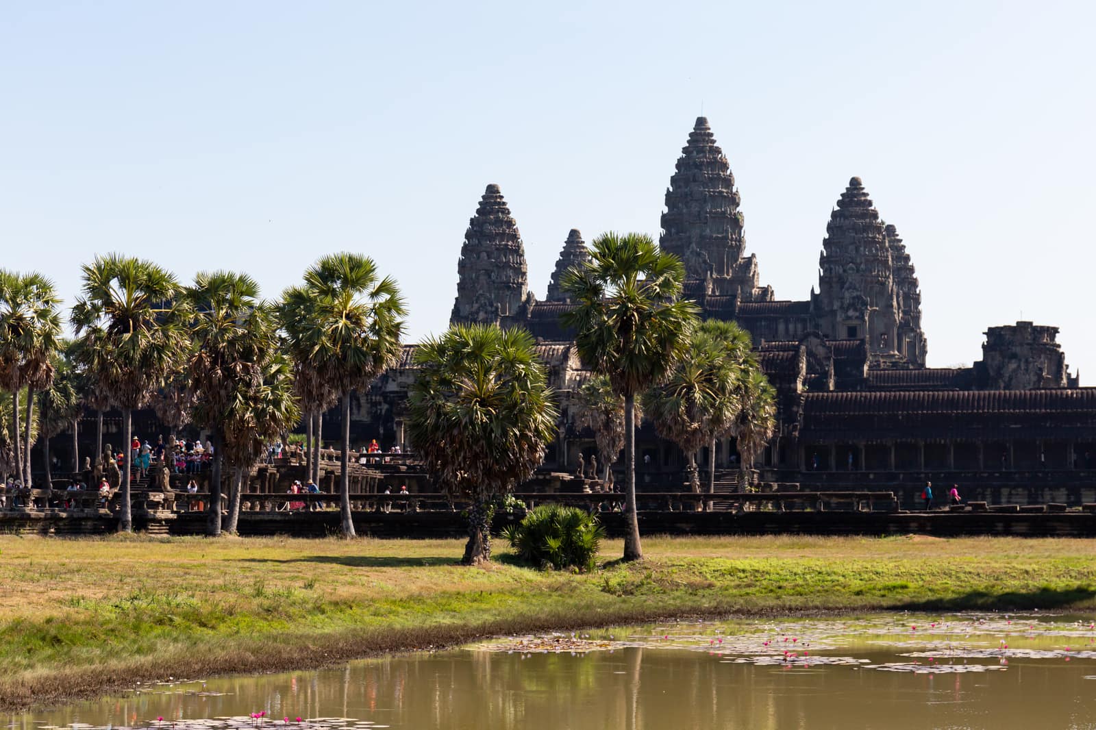
Image veiled by default
Balon Greyjoy, domaine public, via Wikimedia CommonsPDMOriginal record
Data saver is on. Images load only when you ask. You can change this in Settings at any time.
From the archivist
The towers rise like closed lotus buds. The builders made the temple a model of the world as they conceived it: a central mountain, home of the gods, ringed by lesser peaks, by walls and by a moat as wide as a river, standing for the ocean around the earth.
This civilization carved its stories into the walls. In the galleries, gods and demons pull on a great serpent to churn the ocean of milk; armies march in long files; the king sits among his court under parasols. The sandstone was brought from quarries in the hills to the north-east, largely along canals.
It was raised for Vishnu in the first half of the twelfth century. When the king's line gave way and the faith of the country changed, the temple changed with it: Buddhist monks came to live in its courts, and images of the Buddha were set in its halls.
It was never entirely abandoned. People have been coming to pray here for nine hundred years. Its outline is on the flag of Cambodia.
Established
- Angkor Wat was built in the first half of the 12th century under the Khmer king Suryavarman II and dedicated to Vishnu; it later became a Buddhist place of worship (UNESCO; Coedès 1964).
- Angkor, including Angkor Wat, was inscribed on the World Heritage List in 1992 and at the same time on the List of World Heritage in Danger, from which it was removed in 2004 (UNESCO).
- The temple faces west, unusually for Khmer temples, and its galleries are lined with long bas-reliefs of scenes from the Mahabharata and the Ramayana, the Churning of the Ocean of Milk and the army of Suryavarman II (Coedès 1964).
- Airborne lidar surveys published in 2013 revealed, under the forest around Angkor Wat, a grid of roads, ponds and house mounds within the temple enclosure and around it (Evans et al. 2013).
Interpretation
Why Angkor Wat faces west is debated: west is the direction associated with Vishnu, to whom it was dedicated, but also with death, and some scholars have read it as a funerary temple for its founder. The lidar maps suggest that the enclosure was not only a sacred precinct but also a place where many people lived, though who they were and how the space was used are still being studied.
In 10,000 years
In 10,000 years, will anyone still walk its galleries at dawn to pray, or only to look?
Sources (4)
- UNESCO World Heritage Centre. Angkor (property 668), inscribed 1992; removed from the List of World Heritage in Danger in 2004. · whc.unesco.org
- Evans, D. H., Fletcher, R. J., Pottier, C., et al. Uncovering archaeological landscapes at Angkor using lidar. Proceedings of the National Academy of Sciences 110 (31), 2013, p. 12595-12600. · doi.org
- Coedès, G. Les États hindouisés d'Indochine et d'Indonésie. Paris, De Boccard, 1964.
- APSARA National Authority. Angkor Wat. · apsaraauthority.gov.kh