The engravings of Murujuga
- Dated
- Place
- Burrup Peninsula and Dampier Archipelago, Pilbara, Western Australia · Ngarda-Ngarli, the Traditional Owners and Custodians of Murujuga, and their ancestors
- Coordinates
- 20° 38′ S · 116° 48′ E (approximate)
- Remains
- Fragmentary
This fragment shows an object held as sacred.
It is shown here as the institution that holds it presents it. Some communities connected to it ask that it be viewed with care. You may choose to see the image, or read the record without it.
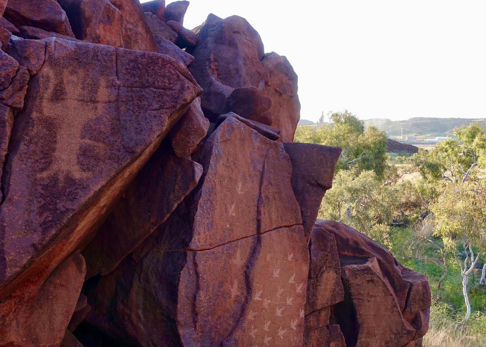

Image veiled by default
Marius Fenger, CC BY-SA 4.0, via Wikimedia CommonsCC-BY-SA-4.0Original record
Data saver is on. Images load only when you ask. You can change this in Settings at any time.
From the archivist
The rocks of this coast are red and dark. The sun and time have burned a thin skin onto them, and beneath it the stone is pale. People learned long ago to strike through that skin with another stone, a peck at a time, until a line of light appeared. With those lines they made animals, people, tracks and forms that only some may read.
They did it here for longer than any archive can count. The sea rose and moved the shore; the engravings kept being made. There are perhaps a million of them, perhaps two, on a peninsula and a scatter of islands. The Ngarda-Ngarli, whose Country this is, still care for them. They say plainly that the images are not the past but part of a living law.
In the 1960s, ports, then gas and chemical plants, were built among the rocks. Some engraved stones were broken, others moved. In 2025 the world listed the place as its heritage, and the flames of the plants still burn on the horizon.
We record this place as it stood between those two fires.
Established
- The Murujuga Cultural Landscape, covering nearly 100,000 hectares of the Burrup Peninsula, the Dampier Archipelago and their sea country, was inscribed on the UNESCO World Heritage List on 11 July 2025 (Murujuga Aboriginal Corporation; DBCA).
- It holds an estimated one to two million petroglyphs, the densest known concentration in the world (DBCA).
- Its Traditional Owners and Custodians, the Ngarda-Ngarli, comprise five groups: Ngarluma, Yindjibarndi, Yaburara, Mardudhunera and Wong-Goo-Tt-Oo; Murujuga Aboriginal Corporation and the State jointly manage the area (DBCA).
- The Custodians describe a record of culture and practice continuing for at least 50,000 years; no engraving has yet been given a secure absolute date, and new methods are being tested to date them (DBCA; Gliganic et al. 2024).
- Before the inscription, the advisory body ICOMOS recommended the removal of degrading acidic emissions and no further industrial development in and next to the landscape, where gas plants, a fertiliser plant and export ports operate (The Conversation, 2025).
Interpretation
How far industrial emissions are damaging the engravings is disputed between studies and between government, industry and researchers. The age of the oldest motifs is still an estimate built on style and weathering. What many engravings mean belongs to the Ngarda-Ngarli, and not all of it is for outsiders to know.
In 10,000 years
In 10,000 years, will the stones remember us by our engravings, or by the smoke beside them?
Sources (5)
- UNESCO World Heritage Centre. Murujuga Cultural Landscape (property 1709), inscribed 2025. · whc.unesco.org
- Murujuga Aboriginal Corporation. World Heritage listing. · murujuga.org.au
- Government of Western Australia, Department of Biodiversity, Conservation and Attractions. Murujuga Cultural Landscape World Heritage Area. · www.dbca.wa.gov.au
- Gliganic, L. A., McDonald, J., Mather, C., White, A. A method to date rock engravings using luminescence, tested at Murujuga, Western Australia. Quaternary Geochronology 85, 2024, 101633. · doi.org
- The Conversation. How the North West Shelf expansion risks further damage to Murujuga's 50,000-year-old rock art, May 2025. · theconversation.com
Related fragments

8700 to 6500 BCE
The Cave of the Hands
Cueva de las Manos, Pinturas River canyon, Santa Cruz Province, Argentina · Americas
before 46,000 years ago
The painted pig of Leang Tedongnge
Leang Tedongnge, karst of Maros and Pangkep, South Sulawesi, Indonesia · Asia