A map of a new network: ARPANET
- Dated
- Place
- Los Angeles, California, United States · United States research community (universities, government laboratories, defence agencies)
- Coordinates
- 34° 04′ N · 118° 27′ W (approximate)
- Remains
- Fragmentary
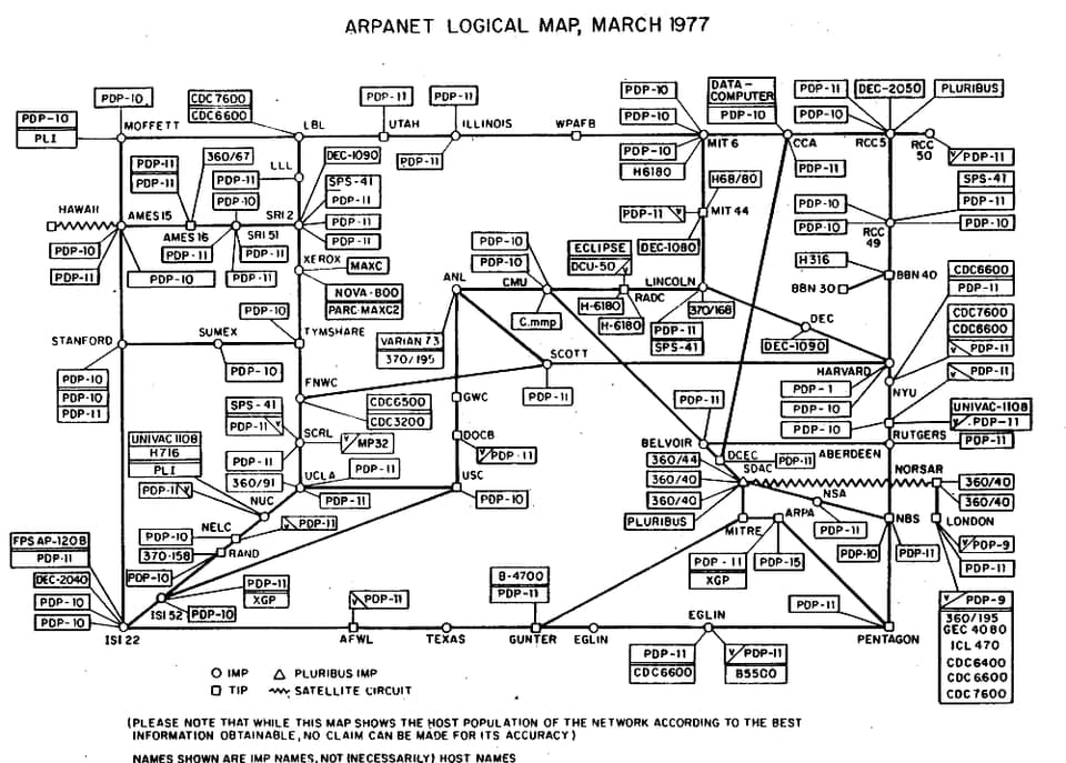

ARPANET Logical Map, March 1977, via the Computer History MuseumPDMOriginal record
Data saver is on. Images load only when you ask. You can change this in Settings at any time.
From the archivist
On the evening of 29 October 1969, in a room at the University of California, Los Angeles, a student named Charley Kline began to type the word login to a computer at the Stanford Research Institute, several hundred kilometres to the north. He sent the l, and the other end confirmed it. He sent the o. Then the distant machine crashed. The first message that this civilization passed across its new network was therefore two letters: lo. About an hour later the whole word went through.
The map kept here was drawn in March 1977. Its lines no longer join four sites but dozens: universities, government laboratories, military bases, a satellite link to Hawaii, another across the Atlantic to Norway and on to London. Each small circle marked a switching machine, each box the computers attached to it. A note at the foot of the sheet admits that no claim can be made for its accuracy. The network was changing faster than anyone could draw it.
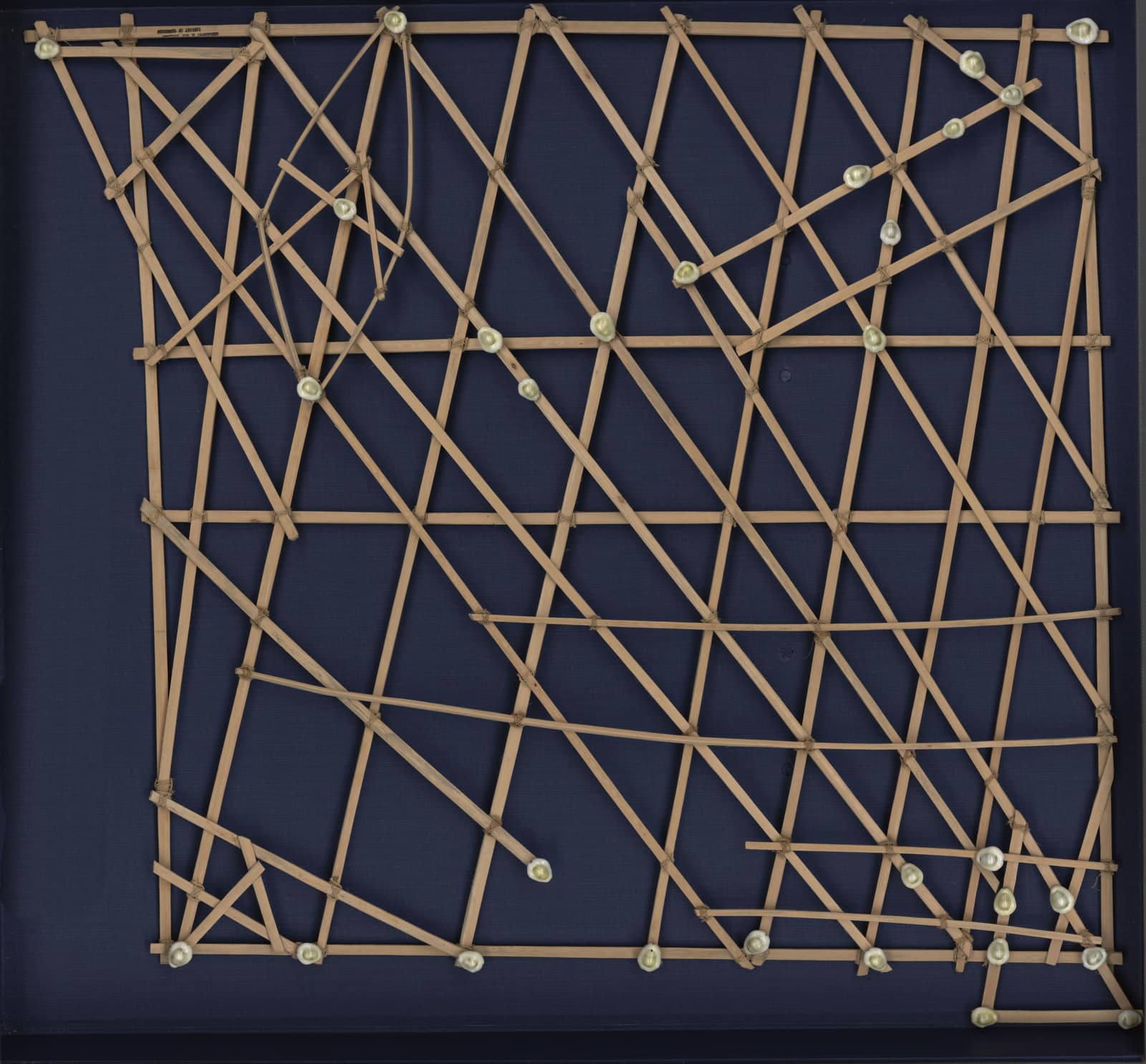
Like the stick charts of the Marshall Islands, it is less a map of places than of passages. In 1983 it adopted the protocols of the internet, and in 1990 it was switched off, its work absorbed into what it had become.
Established
- The ARPANET began with four nodes: UCLA, the Stanford Research Institute (SRI), the University of California, Santa Barbara, and the University of Utah (DARPA).
- Its packet switches, the Interface Message Processors (IMPs), were built by BBN under a contract awarded by ARPA in 1968 (DARPA).
- On 29 October 1969, about 10:30 p.m., Charley Kline at UCLA tried to log in to the SRI computer; the letters l and o arrived before the system crashed, and a full login succeeded about an hour later (UCLA; Computer History Museum).
- The map shown, dated March 1977, lists dozens of sites, including satellite circuits to Hawaii and Norway, and warns that no claim can be made for its accuracy.
- In January 1983 the network moved to the TCP/IP protocols and became part of the internet; the ARPANET itself was formally decommissioned in 1990 (DARPA).
Interpretation
Whether the ARPANET was built to survive a nuclear attack is disputed: its designers stress resource sharing among research computers, while the idea of a network that routes around damage came from earlier studies of survivable communications. Calling lo the first message of the internet is a later framing, since the internet as such took shape only in the 1980s.
In 10,000 years
In 10,000 years, will anyone be able to read a message that only a machine once knew how to carry?
Sources (4)
- Defense Advanced Research Projects Agency (DARPA). ARPANET. · www.darpa.mil
- Computer History Museum. Internet History of the 1960s. · www.computerhistory.org
- University of California. Lo and behold: the internet (on Leonard Kleinrock and the first message of 29 October 1969). · www.universityofcalifornia.edu
- UCLA Connection Lab. 3420 Boelter Hall: where it all began (IMP No. 1 and the IMP log). · uclaconnectionlab.org
Related fragments
1920 to 1929
A map of the swell: Marshall Islands stick charts
Majuro, Marshall Islands · Oceania
1977
The Golden Record
Voyager 1 · Voyager 2 · Americas