Journey · 2 of 2
Measuring the sky
Five fragments on how people counted, predicted and found their place by the sky and the sea, from a notched bone to a golden record now in interstellar space.
- Duration
- About 20 minutes
- Steps
- 5 fragments · 4 continents
- Audience
- For the classroom
- Languages
- English and French
No sign-in and nothing to fill in: a journey collects nothing from students.
The steps
5 steps
- 1The Ishango boneIshango, Virunga National Park, North Kivu, Democratic Republic of the Congo · Africa · c. 20,000 years ago
- 2The Antikythera mechanismAntikythera, Greece (find spot); National Archaeological Museum, Athens · Europe · 205 to 60 BCE
- 3The Timbuktu manuscriptsTimbuktu, Mali · Africa · after 1200 CE
- 4A map of the swell: Marshall Islands stick chartsMajuro, Marshall Islands · Oceania · 1920 to 1929
- 5The Golden RecordVoyager 1 · Voyager 2 · Americas · 1977
JhowieNitnek, CC BY-SA 4.0, via Wikimedia CommonsCC-BY-SA-4.0Original record

1 Africa · c. 20,000 years ago
The Ishango bone
- Dated
- c. 20,000 years ago
- Place
- Ishango, Virunga National Park, North Kivu, Democratic Republic of the Congo
- Remains
- Fragmentary
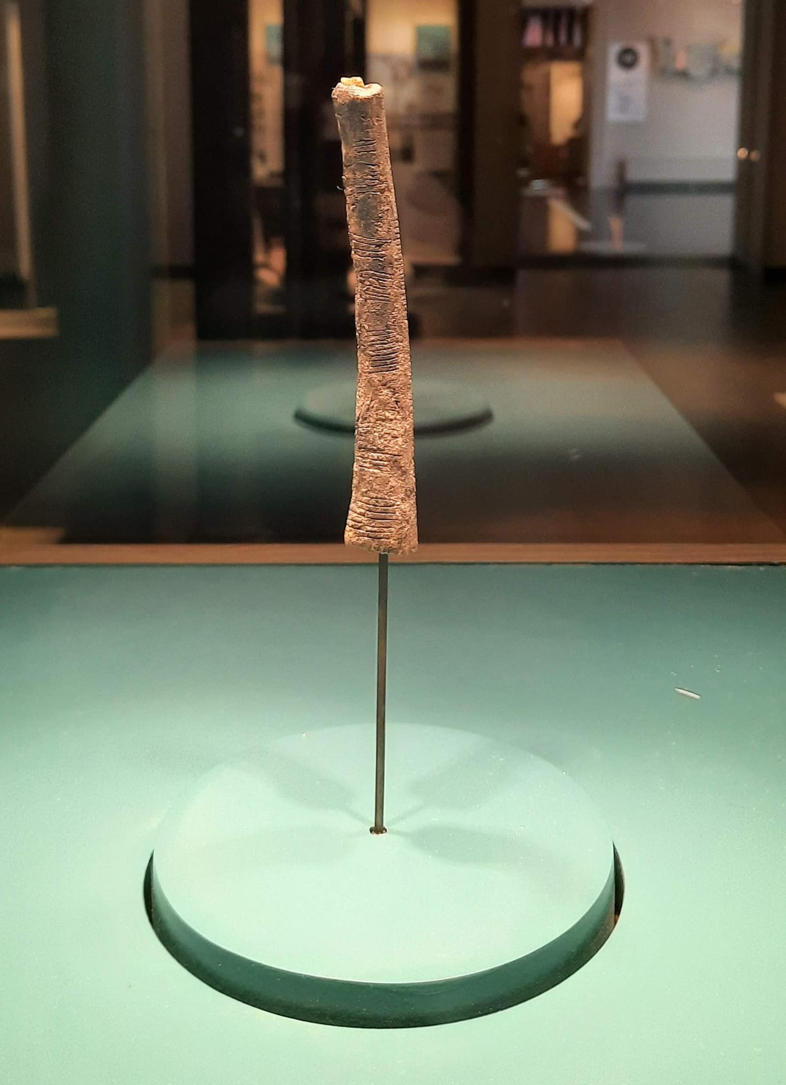
This civilization lived by the water. On the shore of Lake Edward, some twenty thousand years ago, people fished, gathered, and made harpoons of bone. One of them took a thin piece of bone, set a chip of quartz at its end, and began to cut.
The cuts are small and deliberate. They run in three columns along the shaft, gathered in groups, as if the hand had paused between each set and started again. Someone was keeping something: a count, a sequence, a record of days. We do not know which. The order of the groups looks intended, and that is almost all that can be said with certainty.
On the way to step 2
Some read a lunar calendar in these notches; others see a tally or a counting aid. The question is still open. Much later, in the Greek world, bronze gears turned the cycles of the sky into a machine.
Logg Tandy, CC BY 4.0, via Wikimedia CommonsCC-BY-4.0Original record
.webp)
2 Europe · 205 to 60 BCE
The Antikythera mechanism
- Dated
- 205 to 60 BCE
- Place
- Antikythera, Greece (find spot); National Archaeological Museum, Athens
- Remains
- Fragmentary
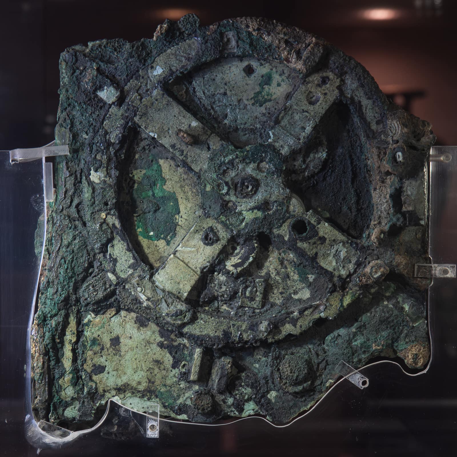
In the first century BCE, a cargo ship went down off the small island of Antikythera, between Kythira and Crete. It carried statues of bronze and marble, glassware, coins, and a wooden case not much larger than a stack of books. Two thousand years under the sea turned the case into lumps of green stone. In 1902, a year after they were brought up, someone looking closely saw a toothed wheel.
This civilization had built a machine to hold the sky. Turn a handle, and pointers moved across its dials: the Moon with its phases and its uneven pace, the Sun through the signs of the zodiac, the calendar of the games, the months in which an eclipse would come. Its teeth were cut by hand in thin bronze, its instructions engraved in tiny Greek letters on its plates.
On the way to step 3
The mechanism predicted eclipses from Babylonian cycles and showed the Sun, the Moon and five planets. In the libraries of Timbuktu, astronomy was copied and studied alongside arithmetic, medicine and law.
Mark Fischer, CC BY-SA 2.0, via Wikimedia Commons (Flickr: fischerfotos)CC-BY-SA-2.0Original record
.jpg)
3 Africa · after 1200 CE
The Timbuktu manuscripts
- Dated
- after 1200 CE
- Place
- Timbuktu, Mali
- Remains
- Fragmentary
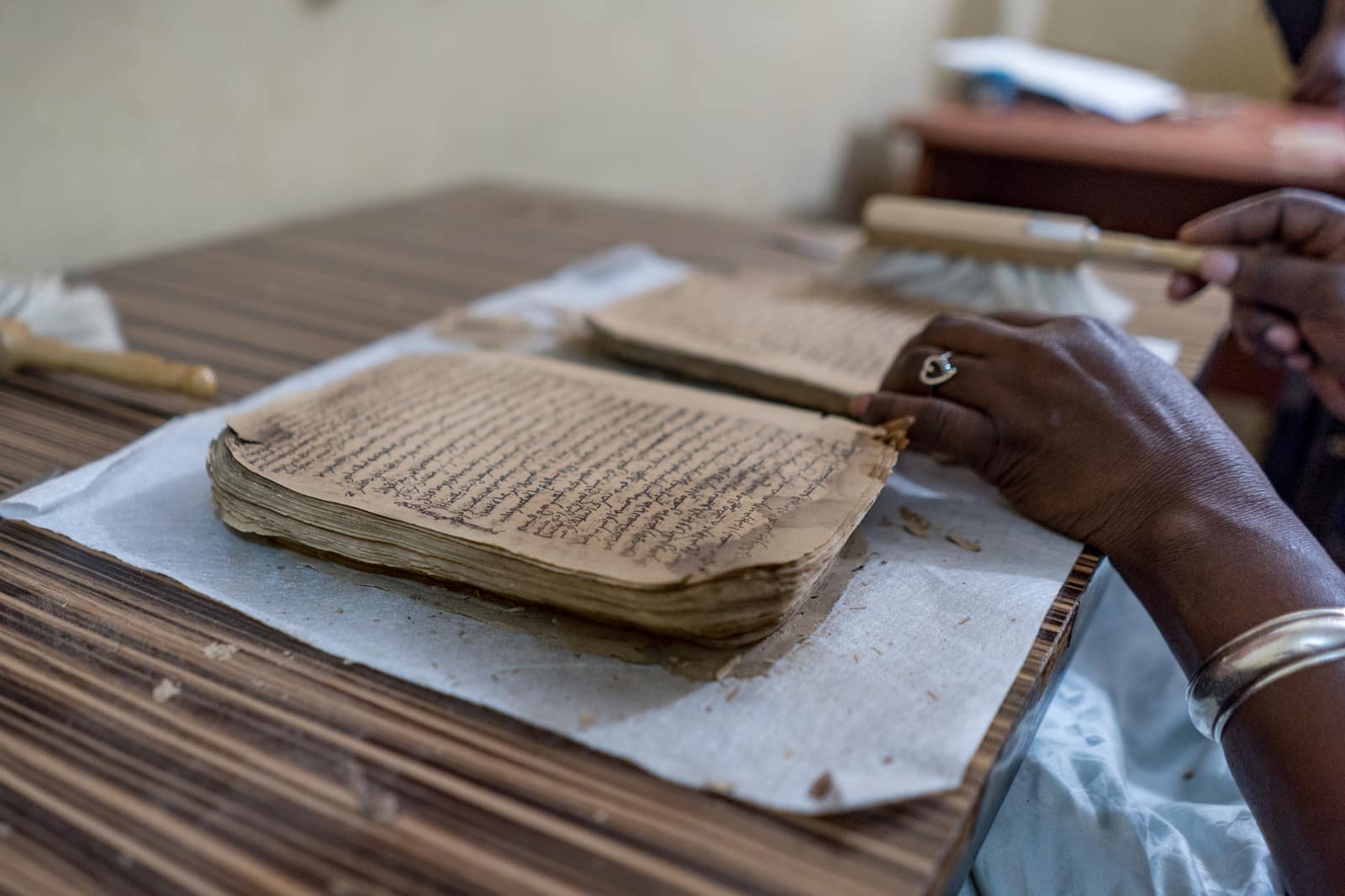
This civilization wrote at the edge of a desert. Timbuktu stood where the caravans from the Sahara met the boats of the Niger, and with salt, gold and cloth came paper and books. Families copied them, bought them, annotated their margins, and passed them down.
The pages speak of everything. How to read the stars to know the seasons. How to divide an inheritance. How to treat a fever with plants and minerals. How to add and multiply. How the soul draws nearer to God. Some are in Arabic, others in African languages written in Arabic letters. Kept in chests and in family rooms, they survived heat, dust and termites for centuries.
On the way to step 4
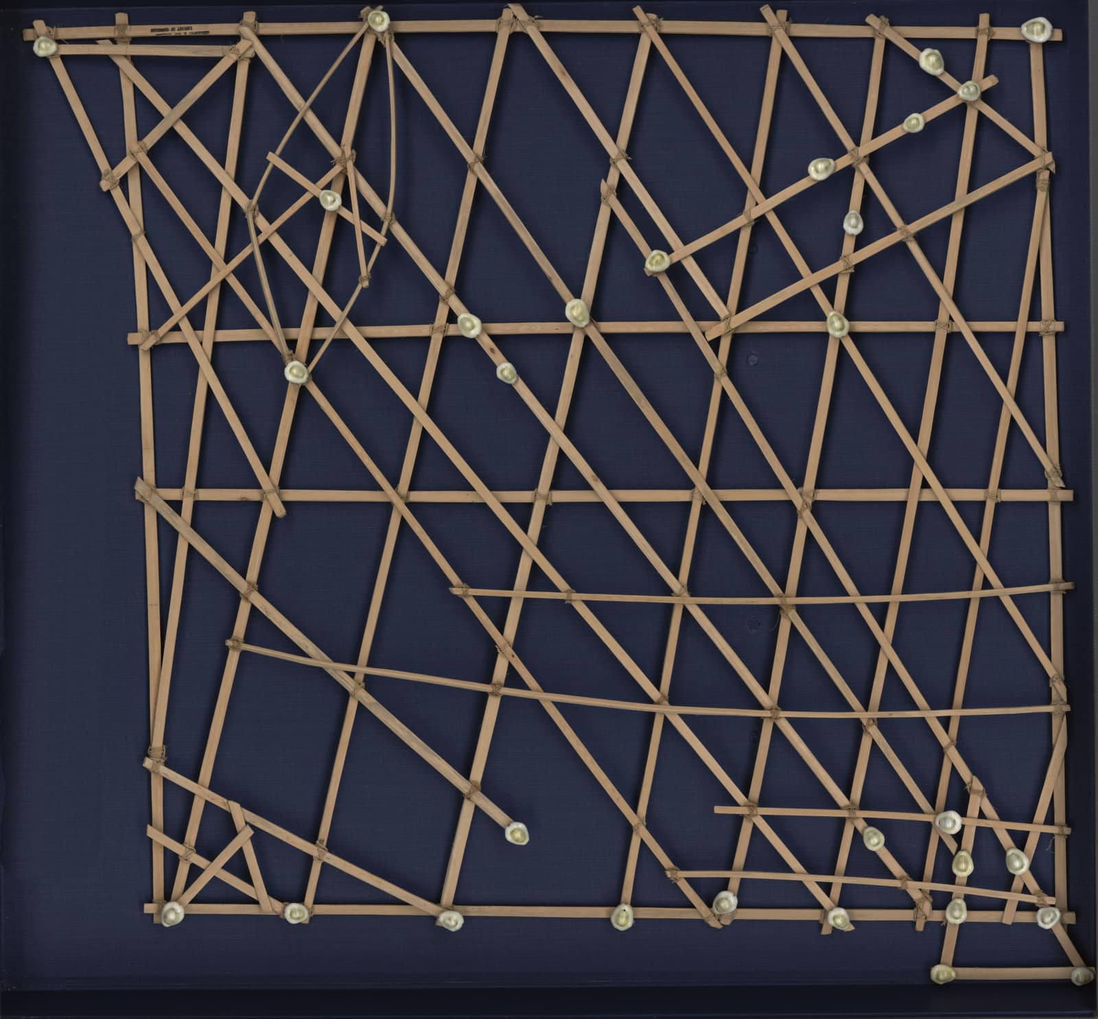
In the Sahel, the sky was read in books. On the Pacific, the sky was not the only guide: Marshallese navigators learned to read the swells, and taught them ashore with charts of sticks and shells.
Library of Congress, Geography and Map DivisionPDMOriginal record

4 Oceania · 1920 to 1929
A map of the swell: Marshall Islands stick charts
- Dated
- 1920 to 1929
- Place
- Majuro, Marshall Islands
- Remains
- Intact
This civilization lived on atolls so low that a coconut palm showed above the horizon only some twenty kilometres out to sea. Its navigators did not look for land; they felt for it. A swell rolling in from the east bent around an island, struck its reef and sent back a fainter wave, and a canoe crossing these meetings of water rocked in a way the body learned to recognise.
What is kept here is how that recognition was taught. Thin sticks lashed with fibre: the straight ones for currents and regular waves, the curved ones for the great ocean swells, and small shells tied on for the atolls. It was never taken to sea. A learner studied it ashore, committed it to memory, then left it behind. The chart travelled inside the navigator.
On the way to step 5
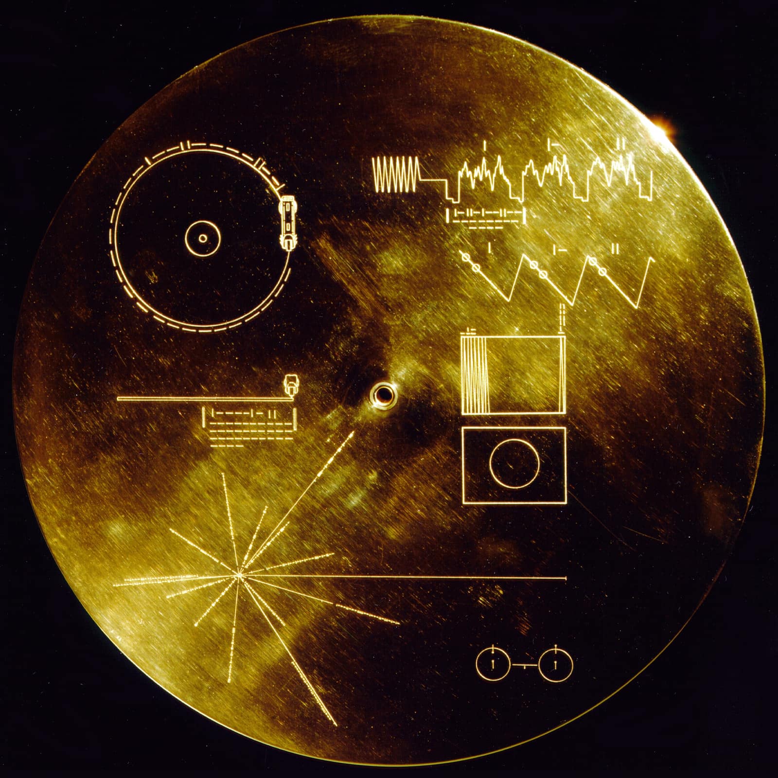
From reading the ocean to leaving the planet: in 1977, a record left the Earth with a map of pulsars on its cover, to show where the Sun is.
NASA/JPLPDMOriginal record

5 Americas · 1977
The Golden Record
- Dated
- 1977
- Place
- Voyager 1 · Voyager 2
- Remains
- Intact
If you are holding this, you found it very far from us. It left in 1977, fixed to the side of two spacecraft, Voyager 2 in August and Voyager 1 in September, and it was addressed to no one this civilization knew.
It is a record: a disc of copper plated with gold, a foot across, packed with a cartridge and a needle. The cover is our instruction for use, cut in lines rather than words: how to lower the stylus, how fast to turn the disc, how to rebuild the pictures stored in the grooves, and where our Sun lay, measured against distant pulsars. A trace of uranium was plated onto it so that you could tell how long it had travelled.
End of the journey
A bone that may count moons, a record that places the Sun among the pulsars: measuring the sky is also a way of saying where we are. Who, in 10,000 years, will read our maps of the sky?